
I’m not going to mince my words here. The Carbeth site north of Glasgow is the flagship of hutting in the UK. It’s long established (since the 1920s), large (98 acres, 143 huts in 2013), and owned by the hutters themselves. The buyout by the Carbeth Hutters Community Company in 2013 and the site’s existence itself has helped fuel the Thousand Huts campaign, which in turn is leading to reform of planning and building control in Scotland in favour of new hutting sites. Visiting Carbeth and going to the 2014 Hutters’ Rally prompted me to start blogging about hutting.
I didn’t take any pictures during that first visit, but this month I had the opportunity to stop by and have a walk round the site with my camera, including up to the planted pine area on the higher ground (which I included in my post about root plates.) I believe the site was just sheep pasture when regular camping started in the 1920s, and it’s notable that like many other hutting and plotland locations, it’s acquired a lot of trees and bits of woodland across the site. Hutting is often an agent of reforestation elsewhere too.

One of the things I try to look for when I visit a site are signs of organisation. How is the place run? What is provided? How well does it work? Is it self-organisation, or some external landowner or local government? As I mentioned above, Carbeth is now run by the hutters’ community company and this first picture is of the noticeboard as you go in with an AGM notice.
 There’s also a community hut nearby with plastic chairs stacked outside and from what I remember of 2014 there’s a small library, board games, tables, and a little kitchen. At the very least you’re going to need so somewhere to hold meetings even when it rains, and it’s a good idea to have a use for it the rest of the time. Some allotment clubs have a village-hall sized shed too. The Humberston Fitties, which is the most similar site to Carbeth in terms of scale, have a Community Room hut (or rather, North East Lincolnshire Council does, and they’ve kept it locked when in disputes with the hutters in the past.)
 Finally, there are basic services like the roadways and water supply, if any. One of the great battle grounds for English plotlands either side of the Second World War was whether the
plotlanders or the council would have the right or the responsibility to maintain roads and water pipes. At Carbeth I could see evidence of roadway repairs and here is a picture of one of the water standpipes and buried pipes that run across the site.
One of the constant questions for hutters is how to provide the services that the site doesn’t. I saw a few clues indicating septic tanks and people collecting rainwater in IBCs. Quite a few TV aerials and even one satellite dish. Some roofs have solar panels or even miniature wind turbines. Almost every roof had a chimney pipe and cowl, and I could smell wood smoke but also coal, and I saw lots of firewood stacks. For many people, self-reliance and spending time relying on simpler technologies that you can maintain yourself is part of the attraction of hutting.
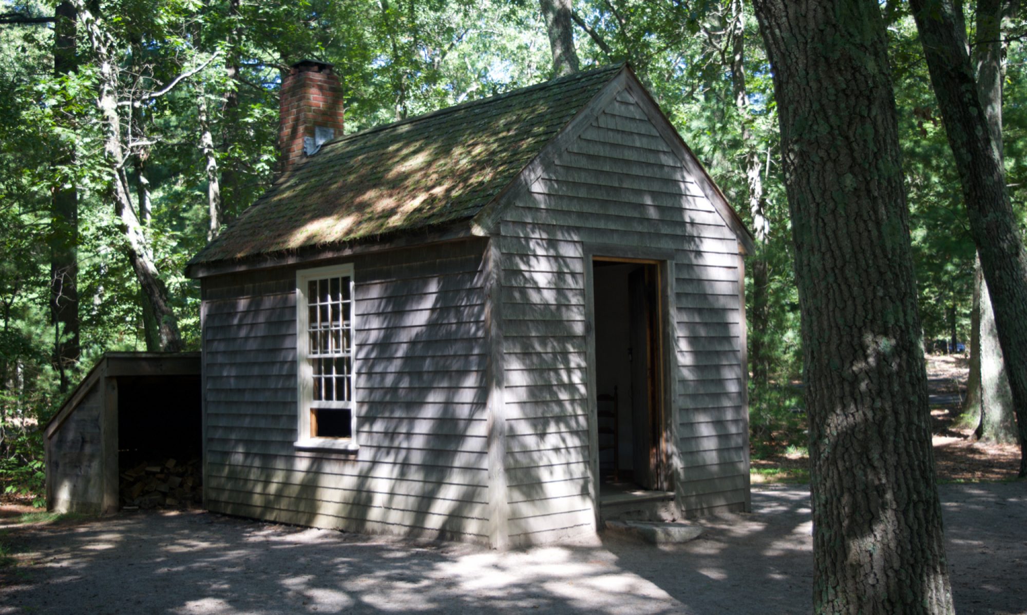
Huts are still being built and rebuilt, often with modern techniques for wooden buildings including waterproof membranes. The oldest huts, that look just like the ones in Humberston from the 1930s and 1950s two hundred and forty miles away in Lincolnshire, tend to be shiplap which needs factory-machined boards. The next four pictures show Carbeth and Humberston huts side by side, both shiplap and overlap.


 The majority that are overlap can be built with much less regular boards than shiplap, even including foot-wide boards with wavy edges done on a portable chainsaw mill at a felling site. I don’t know if that method was actually producing some of the timber for the Carbeth huts, but it does look as if it would be viable. Concrete block foundations were common, including this set laid out on one plot currently without a hut.
 The distribution of huts is quite varied. The site averages two thirds of an acre per hut, but each hut’s plot is much smaller than that. The older ones have acquired fences or hedges, and maybe a few trees and outbuildings. Some are arranged in rows, plot against plot, especially on the hillside near the entrance above the Carbeth Inn. Others are in little groups, including some by crossroads or greens beside the roadways. A few are comparatively isolated, especially on the higher ground.
Carbeth has had it’s ups and downs, but it’s certainly on the up now, with solid collective ownership of the site and new huts being built. Above all, its existence demonstrates that hutting communities can work, and can be thriving almost a century after their foundation.


[googlemaps https://www.google.com/maps/embed?pb=!1m14!1m12!1m3!1d2740.762734558118!2d-4.363016967342586!3d55.98164488633531!2m3!1f0!2f0!3f0!3m2!1i1024!2i768!4f13.1!5e1!3m2!1sen!2suk!4v1461493627703&w=600&h=450]
3 Replies to “Revisiting Carbeth”