Hill Farm chalets near Bewdley

Back in July 2014 when I started this blog, one of my first posts was about Jonathan Meades documentary “Severn Heaven” from 1990, in which he visited the Hill Farm chalet field next to the River Severn near Bewdley. Almost six years to the day I went there myself and it’s still much as it was when Meades filmed it.

There are bits of the film on YouTube and here’s one of the clips, showing the river and the chalets from the air, with Howard Davidson’s rather rousing music.

Continue reading “Hill Farm chalets near Bewdley”

Rudyard Lake

Rudyard Lake in Staffordshire is an artificial lake created at the start of the 19th century to supply the canal network in the area. Once the railways arrived it became a popular destination for people from the surrounding cities, and has the feel of the Lake District.

DSC_0070Along with boats for sailing and rowing, small pleasure steamers, and other water-side entertainments, the lake acquired hotels and guest houses. However, people also built huts and chalets on the banks of the lake and the surrounding hillsides.

Today the lake side is a mixture of public areas, farmland at the north end away from the busier “dam head” at the south, and modern cabins and chalets in private hands on long narrow plots from the lake to a road or bridleway – some of which can be rented for holidays. However, there is a surviving hut site on the far side of a field at the north end.

DSC_0016This first picture shows two huts in a fenced off area in the field to the north side of Reacliffe Road as it turns southeast from running southwest. The huts’ fence has gates and it looks as if they had gardens. There are prominent “Trespassers will be prosecuted” signs near the road and on the huts themselves.

DSC_0010DSC_0004These two surviving huts look pretty run down and unoccupied, but have been repaired with modern materials at some point.

Back down at the dam head is a visitor’s centre, parking, toilets, cafe, boats for hire, and a narrow-gauge railway.

DSC_0036In the trees to the north west of this area is a caravan site, which is often a sign of former hutting sites. I think it was in the woods to the north of this caravan site that Paul Barrett found derelict railway coach bodies in 2014, that presumably had been used as huts. I couldn’t find these this year, but it was quite overgrown this time of year. Judging by historical photographs, it looks as if the whole area has become a lot more wooded than it was at its height, and presumably before that it was entirely given over to sheep farming.

[googlemaps https://www.google.com/maps/embed?pb=!1m14!1m12!1m3!1d1424.0489918338706!2d-2.0951982857005143!3d53.145301432839446!2m3!1f0!2f0!3f0!3m2!1i1024!2i768!4f13.1!5e1!3m2!1sen!2suk!4v1465632915202&w=600&h=450]


Chalets at Haggs Hall Fields, Blackburn

It’s always great to get emails about huts from readers and last year I had a tip-off from John at Bowlandclimber about some huts at Ramsgreave near Blackburn in Lancashire. I’ve finally had a chance to go and photograph them. As you can see from the pictures, they are in a bad way, but it’s a dramatic location and they must have been little havens in their heyday.

The buildings are referred to as “Chalets at Haggs Hall Fields” in a lawful development application from a few years ago, which established that they can be used as holiday chalets in the spring and summer. They’re all in a row on the farm track, and public right of way, leading to Haggs Hall Farm. Each chalet had its own plot as a garden, with bushes, bits of domestic fencing, sheds, and trees on the boundary lines.

Here are the six chalets, from west  to east, two of which are reduced by fire to just the brick chimneys:

haggs_field_chalet1 haggs_field_chalet2haggs_field_chalet3 haggs_field_chalet4haggs_field_chalet5 haggs_field_chalet6

The only evidence I have for the age of the site comes from Ordnance Survey maps. There are no chalets on the field to the south of Haggs Wood on the Six Inch map surveyed in 1910, but when the survey was repeated in 1929/30, four chalets and plots had appeared. The 1:2500 OS Plan of 1968/70 shows the differing footprints of six chalets, with names from west to east: Braeside, Millswood, Beechwood, Kemple View, The Hollies, and Meadowside.

There’s also a classified advert in the “Lancashire Daily Post” from 9th July 1945 right at the end of “Houses for sale” which reads:

SALE, Wood Bungalow; partly furnished; Cabins, etc; v.p. – Apply, The Hollies, Haggs Hall Fields, Ramsgreave, Blackburn.

DSC_0115 DSC_0066Two of the fireplaces shown in the pictures are from around the 1930s or 1950s too, although they may have been recycled when removed from conventional houses.

As I was walking round, I did wonder if the original occupiers were in the wave of hutting by new car drivers in the 1920s, as happened in some Essex plotlands. But a closer look at the map reveals that the Ramsgreave and Wilpshire railway station is about 20 minutes walk away, and the farm track is the first turn off you come to as you walk westwards along Ramsgreave Road away from the last houses.

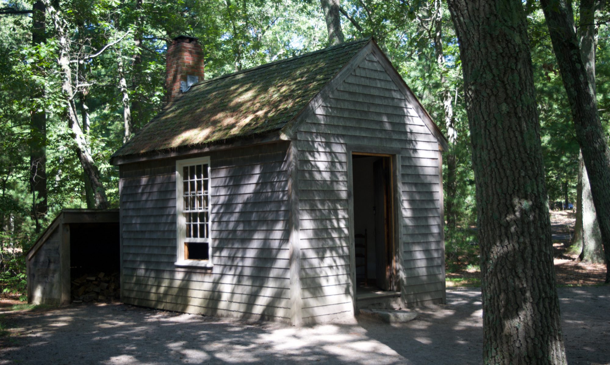
Each of the chalets is different from the next, and entirely constructed from wood apart from the brick chimney, glass windows, and felt or tiled roof. They look just like the kind of buildings people bodged together themselves at weekends up and down the country when plotlands and hutting sites were flourishing. There’s also some plywood and even sections of OSB from the last few decades, and I’m guessing they’ve been continually repaired and modified over the years.

The chalets are now dangerously unstable and the interior pictures were taken through the windows at arms length. I don’t know how long they’ll last, but it looks like an ideal site to benefit from a new wave of hutting.
[googlemaps https://www.google.com/maps/embed?pb=!1m14!1m12!1m3!1d723.6429192297703!2d-2.4937464965634693!3d53.78231419387262!2m3!1f0!2f0!3f0!3m2!1i1024!2i768!4f13.1!5e1!3m2!1sen!2suk!4v1462221549955&w=600&h=450]

Holtsfield and Owensfield on the Gower Peninsula

Holtsfield chaletHoltsfield and Owensfield are two of the chalet fields of the Gower Peninsula in South Wales, originally dating back to the decades before the Second World War that saw similar “hutting” and “plotlands” developments across Britain. The chalets were holiday homes and weekend retreats for “weekenders” from south Wales including the nearby city of Swansea, but over time they have become people’s full time homes. Both chalet fields are adjacent to Bishop’s Wood Nature Reserve which leads down to the coast at Caswell Bay and its beach, and the area has the caravan parks that are often a tell-tale sign of pre-war coastal plotland areas.

In Holtsfield’s case, as you can see from this photo from the early years of the site, the progression was from camping to weekend huts, to a refuge from wartime bombing, and eventually to residential use – and to a much more wooded site as a by-product.

The 14-acre site passed from the ownership of Mr Holt in the 1990s but the new landowner has sought to evict the owners of the 27 chalets to develop the land for much more expensive conventional houses. The Undercurrents.org and The Land Is Ours websites have more about the protests and legal steps the residents took in the late 1990s which has helped they survive there to the present day, although not without some remaining threats to their situation.

Here are two films made around the time of the eviction dispute in the 1990s, first by Undercurrents and then by BBC Countryfile:

https://www.youtube.com/watch?v=W7bA5xNrxgU

The last film is from BBC Wales’ The Slate arts programme:

https://www.youtube.com/watch?v=4GDI8iyY-94

Last year Holtsfield and Owensfield were in the news after Royal Mail deliveries were suspended due to access problems.

These four photos of Owensfield are from the Gower chalet fields album in Stefan Szczelkun’s Plotlands UK Flickr group, which also has images of the Hareslade and Sandy Lane sites:

This Google map shows the two chalet fields, with Holtsfield to the northwest of Owensfield. Holtsfield is at the end of a roadway from Mansfield Road, and Owensfield is at the end of Summerland Lane. If you zoom in, the chalets are quite distinctive in their size and layout when compared to the conventional houses nearby.

[googlemaps https://www.google.com/maps/embed?pb=!1m13!1m11!1m3!1d2987.807234495165!2d-4.031303999999994!3d51.5756049!2m2!1f0!2f0!3m2!1i1024!2i768!4f13.1!5e1!3m2!1sen!2sus!4v1434885852287&w=600&h=450]

Oxwich Bay chalets in the news

Oxwich Leisure Park has one of the chalet communities of the Gower Peninsula in South Wales, and they had the result of their appeal to the Supreme Court yesterday and unfortunately it was bad news. Their service charges will continue to increase by 10% a year, and whereas currently they pay £3000, by the time the leases expire they will each need to pay over £1,000,000 every year. On hearing the outcome, residents were describing their chalets as now worthless.

The court sympathised with the residents but upheld their annual service charge contracts which were signed in 1974. These contracts  agreed to an increase of 10% per year, when inflation was 16% and when 10% looked attractive.  However, the various measures of inflation have been much less for almost all of the intervening years and in 2015 the CPI measure of the cost of living is actually falling. Against that background, 10% per year leads to eye watering increases: £90 per year in 1974 has now become £3000 and will be £1,025,004 each by the end of the leases in 2073.

Despite the harshness of their situation, the judges observed that signing a fixed rate of increase amounted to placing a bet about inflation which could equally well have benefitted the tenants rather than the landowner if things had been different. Nevertheless, there is the possibility of a better outcome, as the landowner repeated her offer to renegotiate the terms of the contract in the tenants’ favour.

The Gower Peninsula has several “chalet field” communities, and the Oxwich chalets appear to be quite modern in style and (re)built in brick rather than the wooden huts I’ve blogged about elsewhere and that are well represented on other Gower sites which I’m planning to blog about in the future.

Huts and chalets near Farndon, Cheshire

farndon2

There’s a chalet field colony of about 50 huts on the banks of the River Dee where it forms the border between Wales and England near Farndon in Cheshire. Last month I walked along part of the river  and took some pictures. Many of the huts look like survivors from the pre-War (pre Town and Country Planning Act) boom in plotland developments, including the Thames-side examples described in “Arcadia for All” that I reviewed in my last post. There are also some modern styles, including Scandinavian squared-log cabins and a scattering of static caravans.

Continue reading “Huts and chalets near Farndon, Cheshire”